"Book your Extreme Wildlife Experience with Seven Safar, where you get Adventurous Jeep Safaris, Luxurious Resorts, Tour Packages and much more."
The Tarsar Marsar Trek is a 7-day journey through the stunning wilderness of Kashmir. Starting from Srinagar, you'll trek through picturesque meadows, alpine lakes, and towering ridges, reaching altitudes of up to 13,100 feet. Highlights include exploring the serene Tarsar and Marsar lakes, surrounded by majestic mountains. The trek offers a perfect blend of adventure and tranquility, with diverse landscapes, serene camping spots, and breathtaking views, making it a must-do for nature lovers and avid trekkers alike.
| Resort Amenities | Inclusions | Exclusions |
|---|---|---|
| Guest house (Triple sharing) | Transport from Srinagar to Aru & return : NON AC | |
| Camping (Twin sharing basis) | Insurance (Mandatory). | |
| Day 1 Dinner to Day 7 packed lunch as per the itinerary. | Food during the transit. | |
| 1 Versatile base camp manager handles communication and deploys extra manpower in emergencies. | Any kind of personal expenses. | |
| 1 Mountaineering & First aid qualified professional trek Leader | Mule or porter to carry personal luggage. | |
| 1 Experienced high altitude chef. | Emergency evacuation, hospitalization charge or etc. | |
| Local experienced guides (Number of guides depending on the group size). | Anything not specifically mentioned under the head Inclusion | |
| Enough support staff. | Hotel stay in Srinagar | |
| Sleeping bag, Sleeping liners (if required), Mattress, Utensils. | N/A | |
| 3 men all season trekker tent (twin sharing), Kitchen & Dining tent, Toilet tent. | N/A | |
| Camping stool, Walkie talkie. | N/A | |
| Ropes, Helmet, Ice axe, Harness, Gaiters & Crampon (if required). | N/A | |
| Medical kit,Stretcher,Oxygen cylinder,Blood pressure monitor,Oximeter,Stethoscope. | N/A |
Altitude: 2,400 m/ 7,950 ft.
Drive Distance(Srinagar To Aru): 112 km.
Drive Time: 4 hrs.
Depart Srinagar by 1 pm.
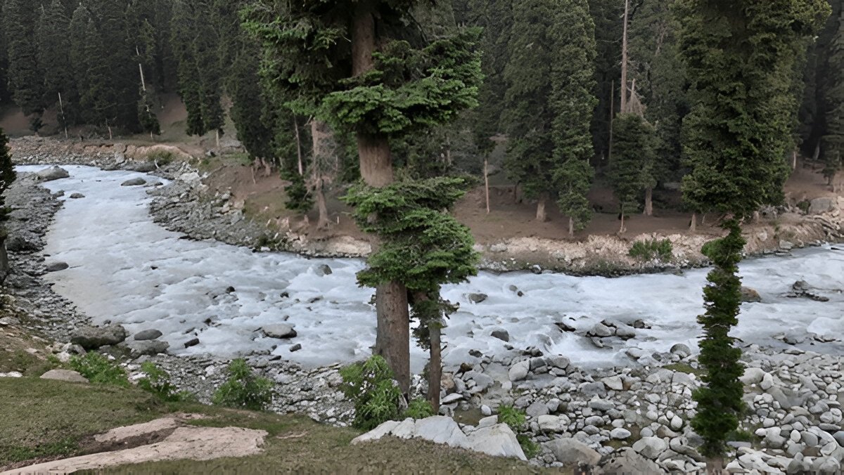
Aru is on the bank of Lidder River.
Since there are no shops around ensure that you have all you need already.
Please note that prepaid SIM cards don’t work in Kashmir.
Pahalgam is the last point where you get a mobile network.
Last ATM is in Pahalgam.
Stay in a lodge/guest house.
Don’t forget to carry your ID proof in original and 2 photocopies.
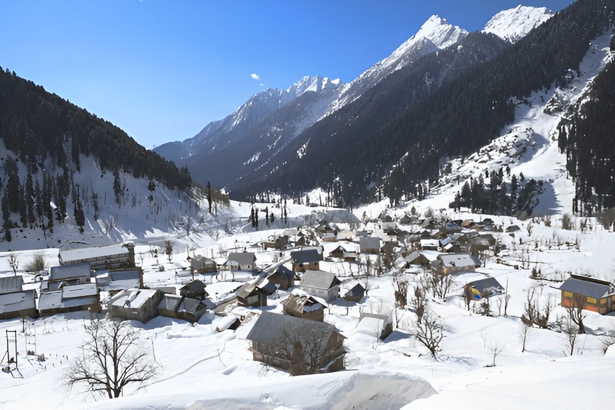
Our first-day destination is Aru on the banks of Lidder and Aru Rivers, situated 12 km off Pahalgam. A fairly developed tourist stop, Aru is regarded as the main base for two well-loved treks - the Tarsar Marsar and Kolahoi Glacier Trek, the destination of the latter being the origin of the Lidder-Aru Rivers.
Our representatives will meet you in Srinagar and from there you will take a short 3 to 4 hrs drive to Aru via Pahalgam. From Pahalgam, two routes go towards Aru, one through the village of Anantnag and one through Bijbhera. Bhijbera route is a tourist trail that presents the beautiful rural scenery of Kashmir with apple orchards, apricot, and walnut trees. Since a steady telephonic network cannot be confirmed at Aru, you need to wrap up your communication at Pahalgam itself. At Aru, you will be welcomed at a riverside camping zone, off the touristy hub, by the sweet-flowing Lidder. There are lots of activities around the town at Aru– from trout fishing in Lidder, and the Aru Biosphere Reserve to horseback riding and heliskiing in winter. You can explore and mark these for a later visit because we will be reaching quite late into the dusk around 6 pm.
Altitude: 2,800 m/ 9,150 ft.
Trek Distance: 10 km | Duration: 6 - 7 hrs.
Altitude Gain: 400 m/ 1,200 ft.
Easy terrain, gradual ascent.
Water can be refilled from streams.
Packed lunch on the way.
Stay in tents.
Today we will be following the Lidder River upstream. The trail starts right out of the village and follows the course of the river. It is a long but gentle climb to Lidderwat. After about 9 to 10 km the trail moves up soft slopes, entering a thicket of conifers, revealing a sweeping view of the Aru Valley down below on the left side. We continue venturing through the forest shade before we arrive at a clearing filled with Gujjar huts. This is the Nandekai Village, inhabited by seasonal, migrating shepherd people, and agrarian, foraging Gujjar community. Here is a slice of idyll, picture-perfect, and a far call from life as we know it. We won’t be crossing through the heart of the village but rather get a priceless bird’s eye view of the picturesque setting as we move uphill. A little after we enter a tumbling meadow as the fir tree thickets completely ebbs away. This is still part of the Gujjar Village ecosystem and you are going to find horse-riding folks and cattle grazers.
The trail cuts across a couple of valley streams next as we go. We soon come across a crude log bridge over the second brook. The streams are very clear and it is safe to drink the water in the stream. This is the spot to refill our water and take some rest, maybe have the packed lunch carried from the last campsite. The Lidderwat locale is still an hour’s journey from here.
The trail here curves into another wooded area of gorgeous firs before coming out into the meadows of Lidderwat, where the river flows clear watered. We can find quaint little Gujjar settlements that mark the very locale. Thanks to tourist inflow in recent times, there are also Pahalgam District Authority Huts and food places established for comfortable stays. There are enough places to pitch camps in this section of the trail.
Our camp would be at a quiet spot close to the stream which is nothing short of a dream. There should be enough time before sundown to walk around the peaceful fir tree-shaded Gujjar settlement and explore the meadows, and then lay out in the dying light on soft grass by the streamside to soak in the tranquillity.
Altitude: 3,350 m/ 11,000 ft.
Trek Distance: 6 km | 5 hrs.
Altitude Gain: 550 m/ 1,850 ft.
Moderate terrain, continuous ascent for a few hours.
Enough water sources on the way.
One river crossing just before Homwas.
Hot lunch at campsite.
Stay in tents.
Today we trek approx 5 hours along a trail winding up directly from behind the PDA homes. The trail starts alongside the Lidder River and in a matter of half an hour you will find yourself inside a forest of pines, the Lidder River is now a distant shadow and the meadows have ebbed away. The woods are not very thick and occasionally open up to wide clearings.
Soon, you will find the stretch of Lidderwat coalescing with a more vast expanse of merging valleys and snow-covered peaks rising straight from the base of the valleys. The grasslands now merge such that it is no longer a single valley but a convergence of many valleys together. There will be multiple clear water streams cutting across our path where you can stop to refill your water bottles.
We will now be heading towards Homwas, which is a little clearing inhabited by a cluster of Gujjar huts and it falls on the other side of the river. After crossing a log bridge, we are ushered into a locality with a few homes and tea shops. You will never fail to find warm hospitality with these villagers and despite the exhaustion of the travels, this makes one’s day.
Crossing the village, you will walk parallel to the crystal river before you enter a different grassy landscape. The walk from Homwas to Shekwas is a delight as you mostly walk on the soft grass. Soon you will arrive at Shekwas. The trail now follows in a south-westerly direction and enters a narrow valley where a beautiful river constantly keeps you company. You will keep gaining altitude and in an hour, you will enter a cluster of Bhoj trees that unfolds into a green scenery stretching in gentle folds to as long as the eyes can see, the meadows of Shekwas are breathtaking. Gujjar habitation and hospitality are ubiquitous in this area too and their little low-roofed, leaf-thatched huts dot the lush landscape here and there. Our trail climbs past the huts onto a slightly higher camping ground. A sweet night, a star-studded night falls over the meadows.
Altitude: 3,800 m/ 12,500 ft.
Trek Distance: 4 km | 3 - 4 hrs.
Altitude Gain: 450 m/ 1,500 ft.
Moderate terrain, continuous gradual ascent.
Carry enough water, only a few natural sources are available.
In the evening explore Tarsar Lake.
Hot lunch at campsite.
Stay in a tent.
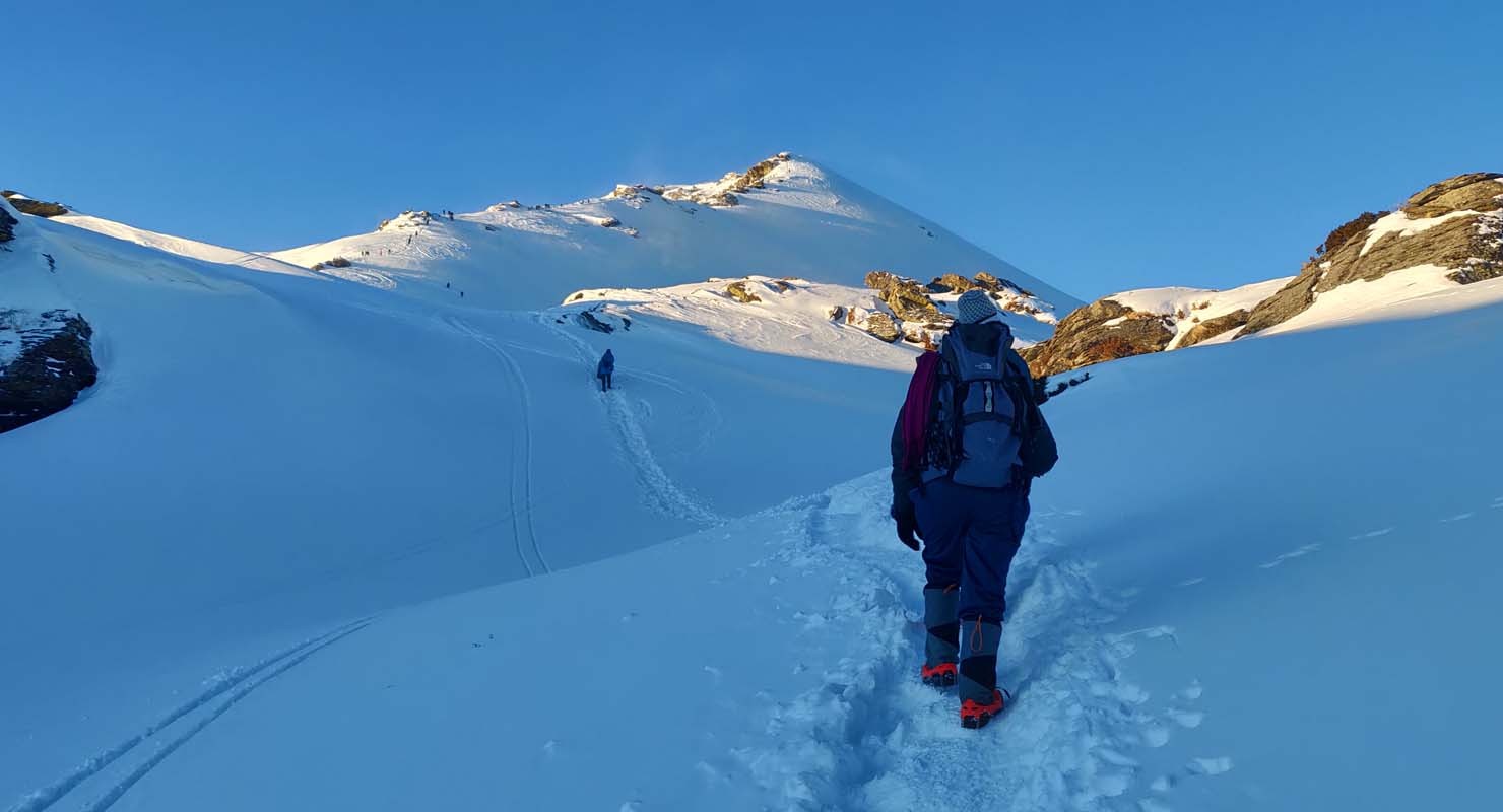
From Shekwas, the trail entwines along a grassy landscape for a while. The green moors of Shekwas are best experienced with bare feet. Try this as you set out of Tarsar Lake today. The agenda today is the trek to the first lake, Tarsar. The trail moves through a silken lawn of nature for some time before climbing over a humpbacked hill and after crossing a few ridges you get a little peek of Tarsar’s magnetic blue waters. You will follow a westward direction in general.
It takes a total of 5 hours to reach Tarsar from Shekwas, the view of the lake widening as we go down succeeding smaller ridges. Every ridge on the trail opens to a stupendous view. The views of the snow-clad peaks become grander as we get closer to the lake. You need to cross the stream, jumping from boulder to boulder adventurously before finally gliding into a verdant meadow around the lake where we will camp at night. Sink your feet deep into the soft grass and watch how the lake water reflects the passing hues of the sky as the day rolls on. Time seems to come to a standstill amid such beauty and silence. There are plenty of flat open spots by the lake where you can pitch your tent. Remember that the entire trek takes place along an eco-friendly zone so please do not litter around the lake or anywhere along your trek and encourage others to not do the same.
Altitude: 4,000 m/ 13,000 ft.
Trek Distance: 6 km | 5 hrs.
Altitude Gian: 200 m/ 600 ft.
Moderate to difficult terrain.
Steep ascent in the beginning till the pass, followed by a descent and then a gradual ascend till Sundarsar campsite.
Carry enough water, only a few natural sources are available.
Hot lunch at campsite.
Stay in a tent.
Today we will trek another 6 km to the adjoining Sundarsar Valley through Tarsar Pass. We delve into a connecting stretch first which joins the meadows of Shekwas and Sundersar Valley. Trekking through the Tarsar Pass is time-saving. Climbing the pass saves about 3 to 4 hrs of the trek. The Tarsar Pass presents beautiful views of the valley that spans out so beautifully. Descend from the pass via the shepherd’s trail and a couple of minutes later, you can spot a few Bakkarval shelters on the left side. From behind the shelter, the trail climbs up to a knoll. Past the knoll is the view of a lush meadow of such astounding beauty that it would inspire poets to emote poetry. Sheep and horses graze on the pastures unmindful of your presence. These are one of the most beautiful meadows with a large pond in the middle and in the backdrop, the snow-covered mountains enhance the scenery. You have to cross a ridge top and climb down to reach the green landscapes of Sundarsar.
You can actually test your stamina on this day’s trek after so many days of walking on gentle undulations. On the ascent to the pass, the trail gets steeper but then mellows down to a gentler slope to Sundarsar. The highlight of the stretch comes with a view of Tarsar Lake from the other side of the Pass. The lakeside offers a perfect camping spot to set up your tents for the night.
Altitude: Marsar Ridge: 4,100 m/ 13,100 ft | Homwas: 3,500 m/ 11,500 ft.
Trek Distance: 11 km | 7 hrs.
Altitude loss: 500 m/ 1,600 ft
Moderate terrain.
50 minutes continuous to Marsar Ridge.
Gradual descent to Homwas.
Packed lunch on the way.
Stay in a tent.
Today we will ascend higher up through Marsar Ridge. Kilting our way around Sundarsar shores, we will be directed to a boulder-smitten path. Two passes from Sundarsar will take you to Marsar Lake. The boulder-laden route that we take is the quicker one. You can expect slippery snow patched in these rock crevasses, just like the white-covered mountains at the end of the valley that we witnessed through our trek in the last few days. At midday, the snow will melt and it’s going to be a tricky walk. Trekking poles and ice axes can be quite a blessing here.
After covering a partly grass-covered, partly snow-sheeted rock trail over the pass, we slightly descend to a flatland that’s cut through by occasional water flows. Keep to the trail on the left and you will spot a ridge that climbs from your left and to the front. They pass a beautiful stretch of green that leads to flatter grounds and after crossing the grassy stretch and hopping over some brooks, you will spot another ridge on your left. The top of the ridge view reveals the translucent blue Marsar Lake lying somewhere down below. It has the same kind of almond-shaped outline as Tarsar and is almost as big. Snow-covered mountains line along the edge of the lake, offsetting its blueness. The lake happens to overflow on one side and go down in a sweeping glacial stream down to a valley below. The snow melts from the white cliffs and feeds its waters on one side and another side, the Dachigam forest starts. The forest reserve climbs almost up to the lake shores. After spending some time at Marsar Lake we will get back to Sundarsar.
We descend back to Sundarsar camps and then to Homwas, trailing almost along the same way that we came by. It takes about 40 minutes of a downhill climb to reach Sundarsar. The descent is full of nostalgia as you relive your experience on the trail once more. Homwas is reached before nightfall, slightly exhausted.
Altitude: 2,400 m/ 7,950 ft.
Trek Distance: 13 km trek | 6 - 7 hrs.
Drive Distance: 112 km | 4 hrs.
Easy terrain.
Continuous gradual ascend till Aru.
Many water streams are available on the way.
Packed lunch on the way.
Stay in Srinagar (not included in cost).
You will reach Aru between 2-3 pm.
You will reach Srinagar between 7-8 pm.
Please note that prepaid sim cards do not work in Kashmir.
Don’t forget your ID proof in original and 2 photocopies.
Starting off early morning today, we descend from Homwas to Aru, sweeping over the same enchanting meadowlands we had experienced on the first days, and the same Lidder River, now to be followed downstream. Descending through this trail will give you some sights that you missed previously when climbing up. This includes the views of the shrinking Kolahoi glacier and the pine forests of Lidderwat from a whole new perspective.
We will stop at Lidderwat to rest and have lunch and then set off again, now towards Aru, 10 km from Lidderwat. It takes about 4 hours approx. to cover the distance.
Srinagar-bound vehicles shall be waiting for us at Aru. We can expect to reach the station within 8 at night.
Embark on a thrilling 4N/5D adventure to the stunning Kedarkantha Peak. Starting from Dehradun, you’...
View this Package
Chopta Tungnath trek serves as an unique adventure, providing you a blend of thrilling challenges, v...
View this Package
The Nag Tibba Weekend Trek offers an exciting and scenic escape into the Himalayas, perfect for adve...
View this Package