"Book your Extreme Wildlife Experience with Seven Safar, where you get Adventurous Jeep Safaris, Luxurious Resorts, Tour Packages and much more."
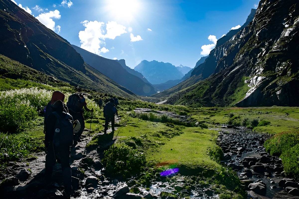
Embark on a 5-day adventure through the spectacular landscapes of Himachal Pradesh with the Hampta Pass Trek. Starting from the charming town of Manali, trek through lush forests to reach picturesque campsites, ascend the challenging Hampta Pass, and be rewarded with panoramic mountain views. Enjoy serene nights by Balu Ka Ghera and Shea Goru, and end the trek with a visit to the stunning Chandratal Lake. This trek offers an unforgettable experience of alpine meadows, towering peaks, and remote mountain villages.
| Resort Amenities | Inclusions | Exclusions |
|---|---|---|
| Camping on Day 1 to Day 4. | Insurance (Mandatory) | |
| From the Day 1st Lunch to the Day 5th Lunch | Food during the transit | |
| 1 Versatile base camp manager: handles communication and deploys extra manpower in emergencies | Any kind of personal expenses | |
| 1 Mountaineering & First aid qualified professional trek Leader | Mule or porter to carry personal luggage | |
| 1 Experienced high-altitude chef | Emergency evacuation, hospitalization charge, etc | |
| Local experienced guides (Number of guides depending on the group size). | Anything not specifically mentioned under the head Inclusion | |
| Enough support staff. | N/A | |
| Sleeping bag, Sleeping liners (if required), mattresses, and Utensils | N/A | |
| 3 men all season trekker tent (twin sharing), Kitchen & Dining tent, Toilet tent. | N/A | |
| Camping stool, Walkie talkie. | N/A | |
| Ropes, Helmet, Ice axe, Harness, Gaiters & crampons (if required). | N/A | |
| Medical kit, Stretcher, Oxygen cylinder, Blood pressure monitor, Oximeter, Stethoscope | N/A | |
| Transportation (as per the itinerary): Manali to Jobra. Chatru to Manali with Chandratal. | N/A |
Altitude:
Manali - 2,100 m / 6,400 ft
Jobra - 3,000 m / 9,800 ft
Chika 3,100 m / 10,100 ft.
Drive Distance (Manli to Jobra): 16km | 1hr.
Trek Distance (Jobra to Chika): 3km | 2hrs.
Enough water through the trail.
Easy to moderate trail.
Stay in a tent
Meeting Time and Place: 12 pm at The Woodbine, Naggar Rd, Manali, Himachal Pradesh 175131.
Reach Chika campsite by 5 pm.
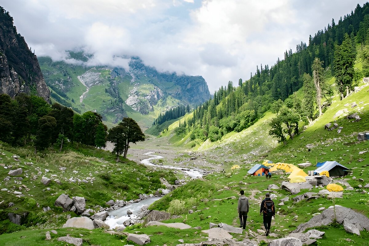
The trekking expedition starts at Manali where you will be driven to Jobra in a vehicle. Manali lies at an elevation of 6,300 ft. so it is a good place to acclimatize before you start the trek. The drive takes you along 40 hairpin bends before you arrive at Jobra, the drive time is around 2 hrs. You will get to see the beauty of the Kullu Valley all along the ride. Jobra is the base for your trek to Hampta Pass. It is situated at an altitude of 9,200 ft and the trek to Chika will take you to an altitude of 10,100 ft.
Today is an easy trek along the banks of Rani Nallah through a mixed forest of pine, green maple, and birches. The trek initiates from Allain Guhugal Hydel Project junction and after you cross the main road, you follow the small path leading into a forest of Pine trees and other conifers like Maple, Oak, Deodar, and Toss. The slope that you will climb is not steep and is quite easy to climb. The surroundings are very beautiful, take a moment to appreciate the beauty of the environs before heading into a lush meadow strewn with small rocks all around. Twenty minutes into the trek and you will arrive at the bend that overlooks the meadow.
A little into the meadow the Rani Nallah comes into view, it flows through the middle of the meadow making it look like a picture right out of a fairytale. Walk through the meadow or climb up the hill on the left-hand side, either way, you will reach Chika at the end of the vast meadow. Climbing the hill and descending to Chika is the easier route and the campsite lies in a huge patch of a green clearing. Rani River flows through the middle, which makes the perfect setting to pitch up a tent. You may also spot horses grazing in the meadows that make a perfect setting for some Instagram-worthy photographs.
Altitude: 3,800 m/ 12,400 ft.
Trek Distance: 9 km | Duration: 5 to 6 hrs.
Altitude Gain: 700 m/ 2300 ft.
Moderate trail, gradual ascent.
A packed lunch will be provided.
Enough water on the way.
River crossing, boulder walk, and colorful tiny flowers on the way.
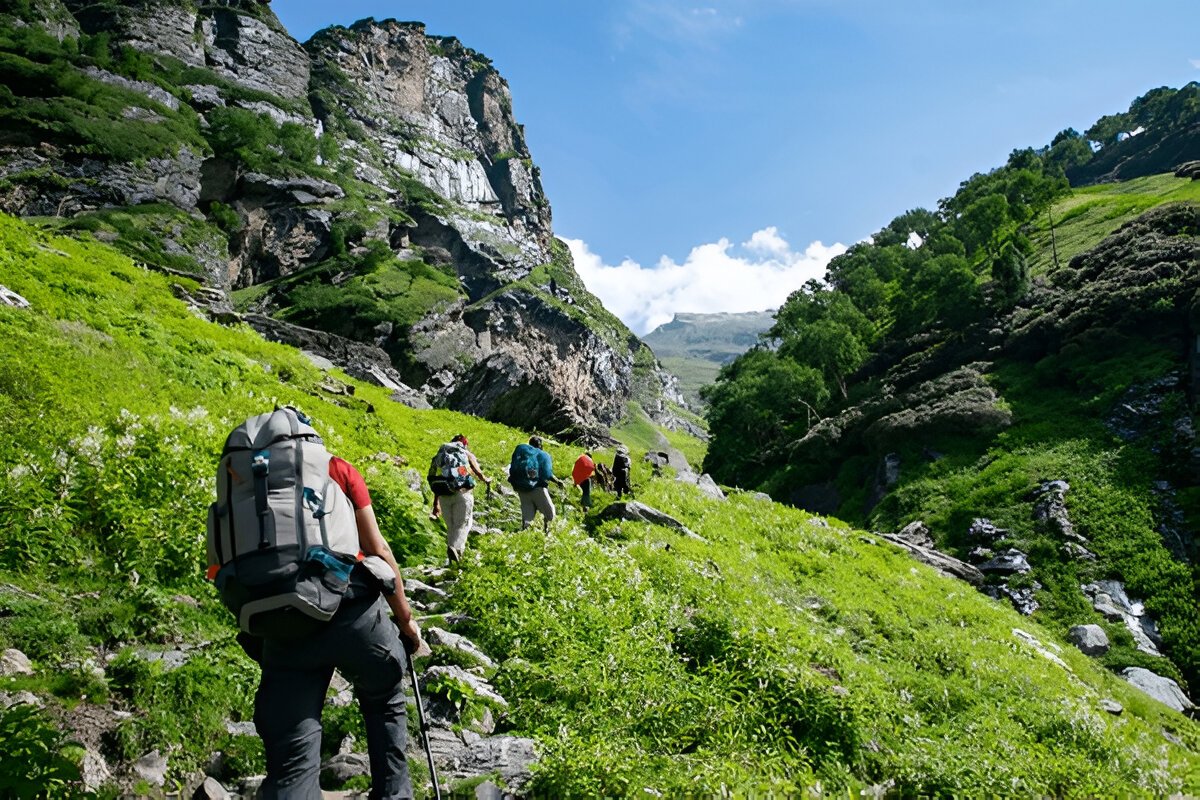
The next destination is Balu Ka Ghera. While the area is not visible from the Chika campsie, from the direction of the trail you can guess that it falls on the right-hand side. The trail will lead through boulders and rough terrain and the grade of the trek today is also an easy one and can be completed without any difficulty.
The entire stretch of the river's right bank is lined up with amazing dwarf Rhododendron trees. These trees will cover the lower and the central region and a cluster of silver birch trees cover up the upper region. Once you have reached the end of the silver birch trees, wait a moment and look back to marvel at the entire range of Dhauladhar snow-clad peaks in front of you. The view is very picturesque. You will reach a clear stream waterfall to the left at a distance. This is the best place to fill your bottles.
After crossing the waterfall, the next route is towards the river to your left. You can go to the other side only by crossing the river but you will have to wet your feet. Fair warning, the water is super cold and will prick your feet. You can also jump from one rock to another in the stream and get to the opposite side. You must have finished half of the day's trek when you enter Jwara. Jwara is a beautiful scenic sheltered valley; with huge snow-clad rocks at one side and the valley drops down to the river on the other side. You will feel like immersing yourself in the beauty of God's nature. You will find snow melting into the river and cattle grazing the land.
In front of you are snow-clad mountains. From here, the trail entwines along the riverside which will lead you to another rectangular valley. The path is covered with multi-colored flowers. The last of the tree lines vanish out of sight and are left behind. It will take another half an hour or so to reach the end of the valley, which is the finishing part of Jwara. After Jwara, the path is a slope covered with snow and rocks. You will spot a variety of purple, yellow, and pink wildflowers along the way. The terrain flattens out as you progress towards Balu Ka Ghera. You have to walk along a path of rocks and boulders and the rocks become more and more sparse as you progress towards Balu Ka Ghera.
Balu ka Ghera marks the end of the path, the name has nothing to do with the place. The place is covered with snow and greens whereas the name implies a mound of sand. But it is said that this place was formed with the sands and dust deposited by the river and hence the name. Balu ka Ghera campsite is a flat ground amidst the mountains that you will cross the next day to reach the pass. Balu ka Ghera is at an elevation of 12,400 ft.
Altitude: Hampta Pass - 4,300 m / 14,100 ft | Shea Goru- 3,900 m/ 12,900 ft
Trek Distance: 7 km | Duration: 10 hr
Altitude Gain: 520 m/ 1,700 ft.
No water point on the way (depends on the condition of snow)
First 1 hr gradual ascent then steep ascent till the pass
Packed lunch at the pass, enjoy the view of Indrasen Peak
Around 2 hrs of steep descent and 1 hr of flat walk from the pass to the campsite
The coldest part of the trek
Stay in a tent.
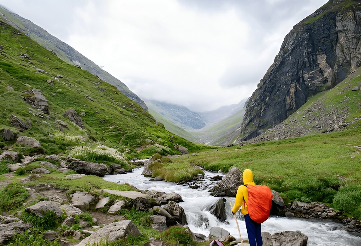
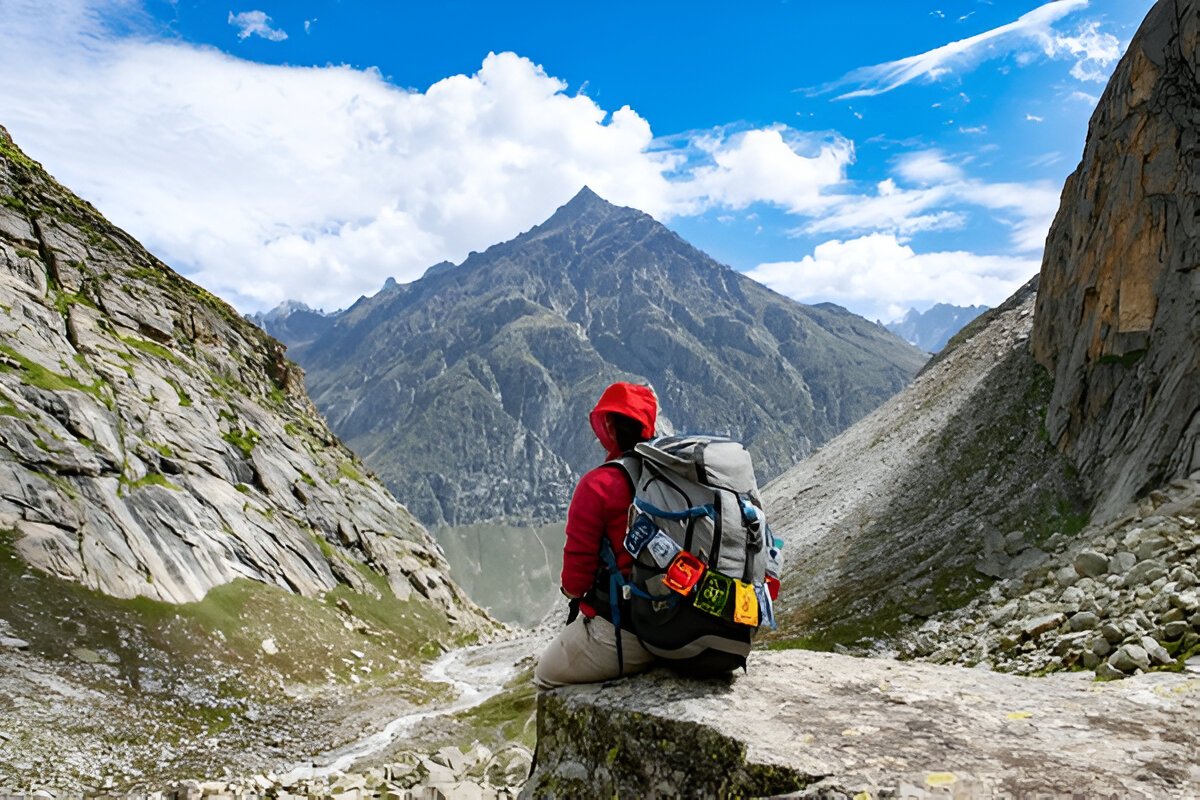
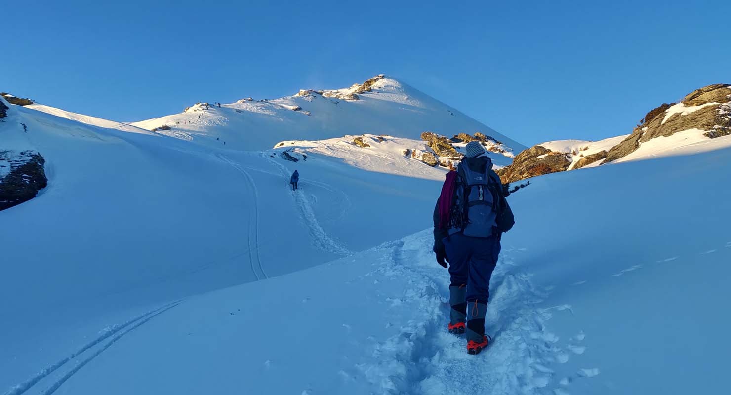
You can split the journey into two halves, a steady ascent on a moderately steep slope to Hampta Pass, hence a sharp descent to Shea Goru. The highest altitude will be achieved on this day at Hampta Pass (14,100 ft). The day starts by heading towards the mountains you spotted the previous day near Balu Ka Ghera. The trail is along the riverside. The view is amazing, tiny yellow and orange flowers along the river banks enhance its beauty.
The riverside trails take you further to the base followed by the actual climb to the Hampta pass. The trail fades out at some point so be mindful to not get lost. When trekking with us, our trek leaders will lead you through the right trail so no worries about wandering away. It will take an hour to reach here. Another hour of the walk will take you to the first plateau. In summer, the place is completely covered with thick fresh snow. Otherwise, it is just patches of snow everywhere.
You will reach another plateau and onto a ridge. It will take another half an hour to reach the ridge's end. Then from the first ridge trek further up to the second ridge. Hampta Pass is just a few meters and a bend away from the second ridge. The climb to Hampta Pass is a vertical one and is a hard mount. It will take about 15 minutes to reach the pass. Yes, by the time you reach there, you will be extremely tired but the site which unfolds in front of you is supremely stunning. Enjoy for some time in the pass, relish the beauty around, have your lunch and then get ready for the next descent to Shea Goru.
The descent is trickier than the journey to the pass. The decline is so steep that you would not be able to locate the base of the mountain, not even by craning your neck. The best possible way to get down is either by sliding down the slope if there is snow or with the use of ropes for support. The route is a little meandering too. You will also spot Spiti from this point. In an hour and a half, a final u-turn will bring you to the base of the valley and the trail ahead will lead you to Shea Goru. The valley is secured by snow-clad mountains, and the side which is open is way to Shea Goru. The trek to Shea Goru is easy and on flat land. The river again flows to your right. Like Balu Ka Ghera, the Shea Goru campsite is also by the riverside. Set your camps on the grounds and retire for the night with a feeling of contentment at the heart.
Altitude: Chatru- 3,350 m/ 11,000 ft.
Trek Distance: 7 km | 5 hr.
Drive Distance: 50 km, 3-4 hr to Chandratal and back to the campsite, either on day 4 or day 5 (depending on road and weather conditions).
Altitude Loss: 550 m/ 1,900 ft.
Gradual descent on the moraine.
Start early in the morning.
2 to 3 water sources on the way.
Hot lunch at campsite.
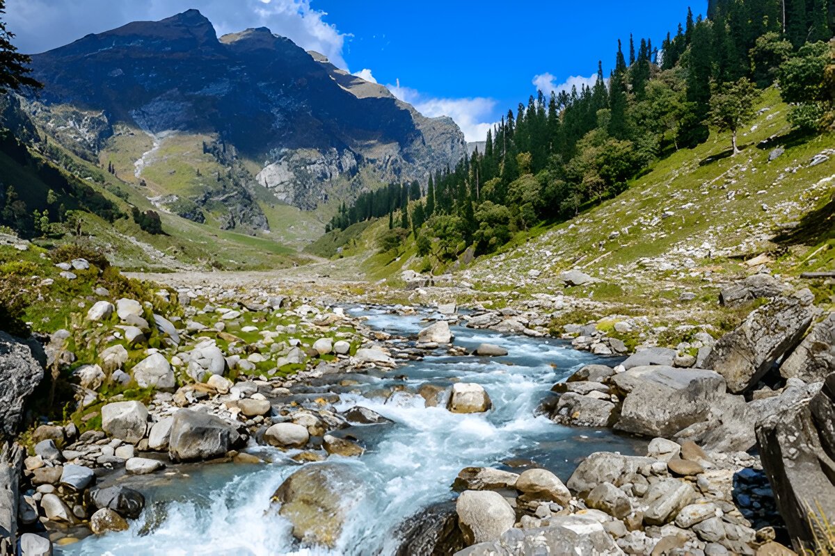
You will cover Shea Goru to Chatru by foot and it will take approx 5 hours of easy downhill trek. Shea Goru is placed at an altitude of 12,900ft and Chatru at 11, 000ft. It is a gentle trek downhill from Shea Goru. The trail here again is by the side of the river valley between mountain ranges. Some places can be a little slippery so be careful.
Chatru can be located at a distance. No vegetation can be seen in the barren mountains. The tricky part comes next. You will have to be careful as the trail might sometimes lead you to the edges of mountains and ridges. The route has slippery parts too. So, sure-footed and careful navigation is required to go further. Nevertheless, the trek is not as difficult as it sounds. You will for sure enjoy the sliding. Getting down the mountains will consume another two hours of your time. You will notice the Chandra River flowing below and a road that goes by its side. More than two Glaciers come next which are to be crossed. The other side of the Glacier is Chatru, the next camping zone. Choose a location that has the river running around.
Chatru is a magnificent camping site; it is a consensus of the three passes, Hampta, Rohtang, and Spiti. The location is just about another two hours away.
Drive Distance: 65 km | Duration: 5-6 hr.
Breakfast at the campsite.
Lunch on the way (not included in cost).
Make your further travel plans from Manali.
It is time to say goodbye to the Spiti Valley and head back to Manali. A ride back from the Chatru campsite to Manali is scheduled for day 5. After this 5 hour journey full of mellow reminisces of the hills, you will be reaching Manali in the afternoon. An overnight journey after 06:00 pm to Delhi will hopefully work out best.
Chandratal Lake
A visit to Chandratal will be either on Day 4 or Day 5. You can hike up to the marvelous Chandratal Lake (known as the moon lake). Chandratal Lake is 50 km from Chatru campsite. The sheer blue color of the lake has an amazing effect on the surroundings. You can visit Chandratal only in the summer months if road and weather condition permits us. If not, you will have to drive directly from Chatru to Manali and skip Chandratal altogether.
Embark on a thrilling 4N/5D adventure to the stunning Kedarkantha Peak. Starting from Dehradun, you’...
View this Package
Chopta Tungnath trek serves as an unique adventure, providing you a blend of thrilling challenges, v...
View this Package
The Nag Tibba Weekend Trek offers an exciting and scenic escape into the Himalayas, perfect for adve...
View this Package