"Book your Extreme Wildlife Experience with Seven Safar, where you get Adventurous Jeep Safaris, Luxurious Resorts, Tour Packages and much more."
The Kashmir Great Lakes Trek is an extraordinary 8-day adventure through the pristine landscapes of the Kashmir Valley, offering trekkers a chance to explore some of the most stunning high-altitude lakes in the Himalayas. Starting from Shitkadi camp, the trek takes you through mesmerizing trails, lush meadows, and challenging passes. You’ll hike to the famous lakes of Vishansar, Gadsar, and Satsar, each offering breathtaking views of snow-capped peaks and serene waters.
The trek also includes a challenging ascent through Nichinai Pass (4,000 m) and Gadsar Pass (4,200 m), with stunning views from the top. A rest day at Vishansar Lake allows time for acclimatization, and there’s an optional visit to the nearby Kishansar Lake, depending on the weather.
On the final day, you’ll trek to the picturesque Gangbal Twin Lakes via Zaj Pass before descending to Naranag and returning to Srinagar. With its majestic views, tranquil lakes, and the thrill of high-altitude trekking, the Kashmir Great Lakes Trek is an unforgettable journey for seasoned adventurers and nature lovers alike.
| Resort Amenities | Inclusions | Exclusions |
|---|---|---|
| Insurance is Mandatory. | Food during the transit. | |
| Camping while the trek (Twin sharing basis) | Any kind of personal expenses. | |
| Meals while on trek (Veg & Egg) | Mule or porter to carry personal luggage | |
| Day1 dinner to day8 lunch | Emergency evacuation, hospitalization charge, etc | |
| 1 Versatile base camp manager handles communication and deploys extra manpower in emergencies. | Transport from Srinagar to Shitkadi camp and Narnag to Srinagar (Rs 1,700/-) | |
| 1 Mountaineering & First aid qualified professional trek Leader. | Anything not specifically mentioned under the head Inclusion. | |
| 1 Experienced high-altitude chef. | N/A | |
| Local experienced guides (Number of guides depending on the group size). | N/A | |
| Enough support staff. | N/A | |
| Sleeping bag, Sleeping liners (if required), mattresses, and Utensils | N/A | |
| 3 men all season trekker tent (twin sharing), Kitchen & Dining tent, Toilet tent | N/A | |
| Camping stool, Walkie talkie. | N/A | |
| Ropes, Helmet, Ice axe, Harness, Gaiters & crampons (if required). | N/A | |
| First aid | N/A |
Altitude: 2,600 m/ 8,500 ft.
Drive Distance: 90 km from Srinagar | approx 3 hrs.
If booked in advance, TTH can arrange pickup from Nishant Garden, at 12 pm.
Our campsite is near the Sindh River (Shitkadi Village)
Since there are no shops around ensure that you have all that you need already
Remember to carry your ID proof in original and 2 photocopies as we have to submit them at the army check post.
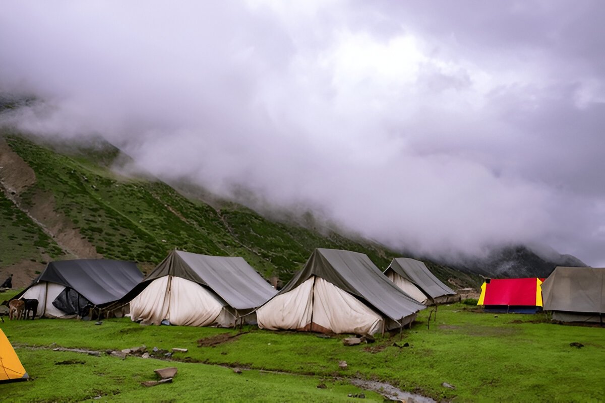
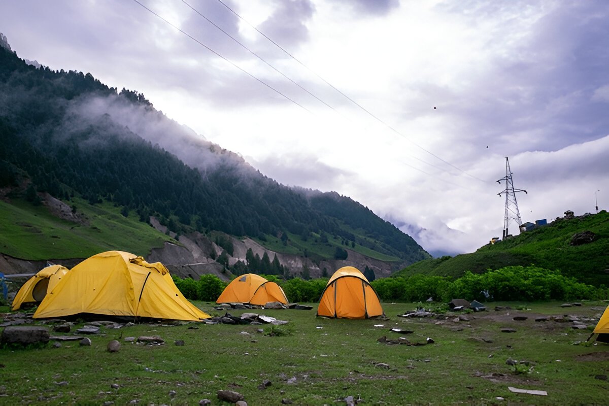
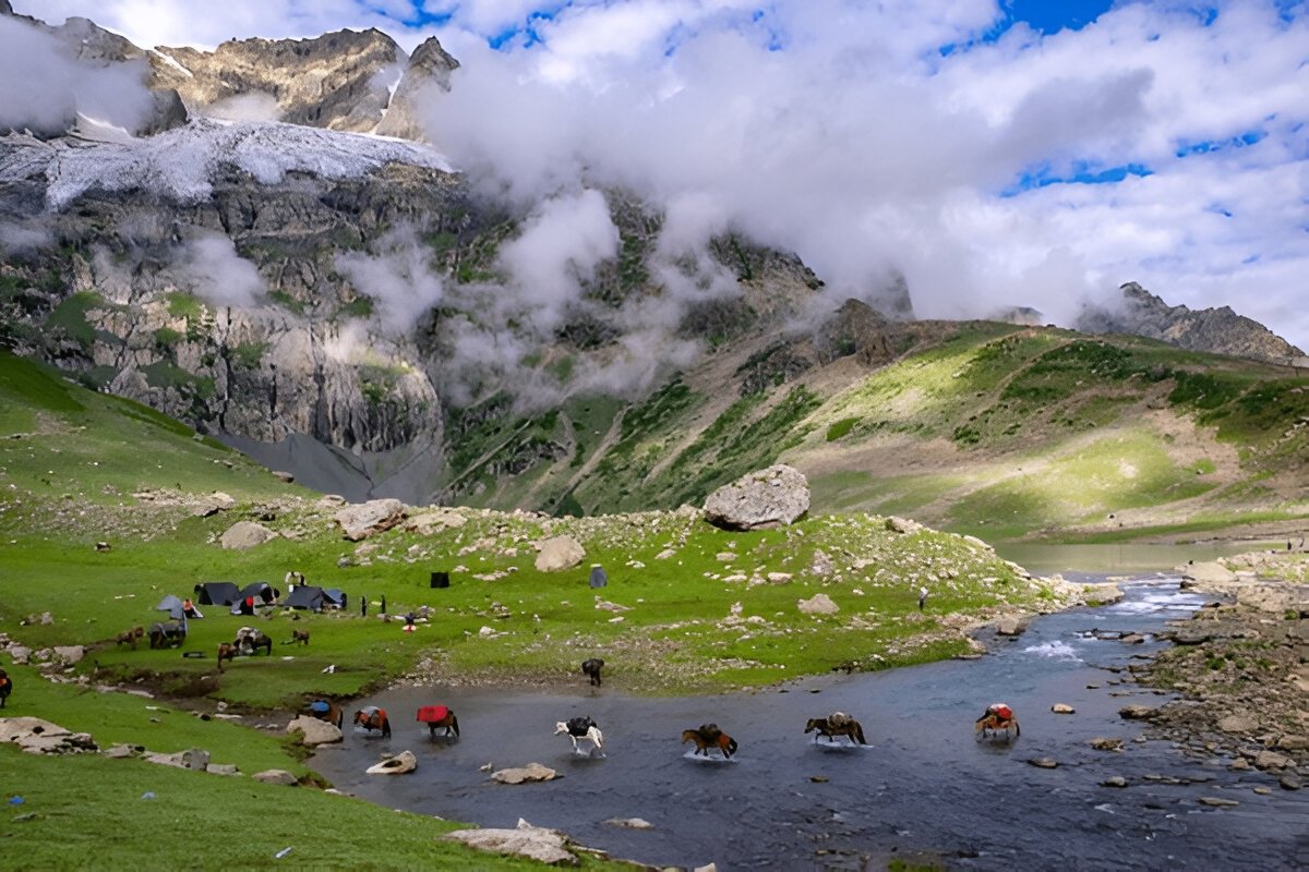
The journey to Kashmir Great Lakes begins from Shitkadi Village, which is a little ahead of Sonamarg and about a 3-hour drive from Srinagar. TTH representatives will pick you up from Sonamarg and drive all the way to Shiitkadi, where you will rest for the night before beginning your trekking adventure the next day. Before you begin your trekking adventure, you will spend the day in the beautiful surroundings of Shitkadi Village. You can spot some of the great mountain peaks like Kolahoi, Tribal, Machoi, Amarnath Peak, and Machoi Glacier. The view en route to the campsite is very scenic and all along the route, you will see the vast expanse of grasslands and meadows on either side of the road. The stay is arranged at Shitkudi Campsite. There will be a briefing session in the evening before dinner. Dine early and give your body enough rest to begin your trek tomorrow.
Altitude:
Nichinai 3,500 m/ 11,500 ft.
Shekdur 3,350 m/ 11,000 ft.
Trek Distance: 11 km | 8 hrs.
Altitude Gain: 900 m/ 3,000 ft.
After breakfast, we trek to Nichinai via Shekdur.
The trail takes you through meadows, and dense forests with Maple, Pine, and Bhoj trees.
After approx. half an hour, we get to an army check post where we have to submit our ID proofs.
While you are at it, you can enjoy an awesome view of the Sonmarg Valley or the Thajiwas Glacier
The trek from Shitkadi to Shekdur goes through thick forests of pine trees and will take approx. 2 and a half hours
At Shekdur, you can indulge in instant noodles and an omelet if you wish to.
We follow the Nichinai stream as we trek from Shekdur to Nichinai.
We have lunch at the Nichinai stream.
3 hours ascent followed by 1 hr descent and finally a gentle ascent to Nichinai (6 hrs, 9 km).
The trek starts 3 km out of Sonamarg, on Srinagar Road. Exactly at the 3 km mark, spot a lone Dhaba on the right. The place also sells packaged water, biscuits, etc., and is your last place to pick up any snacks or little bites. The next trace of civilization can be spotted at Naranang after the trek.
A jeep track diverts to the right off the main road at the shop. The track goes down to the level of the Sindh River that flows in between the mud track and the main road. The trekking trail starts along the track but quickly diverts higher up. 10 minutes into the trek, the trail bends and enters a green meadow. The meadow directly overlooks Sonamarg town. In half an hour, you reach the top of the meadow from where tree lines of Maple and Pine start. Once you reach the tree line, the trail descends until a tiny brook and then climbs up again and what follows next is a lovely dense forest of Maple trees. Walking on green beds of grass amidst the Maple cover is an experience unique to Kashmir in India.
For the next hour and a half, the trail winds up through Maple trees. Stick to the trail that goes in an uphill direction as the one heading down diverts into the nearby villages. Occasionally, the trees give way to clearings. Turn around and delight in the spectacular view of the Sonamarg Valley that gets bigger and fuller as you keep gaining altitude. The Maple cover accompanies you to the top of the ridge and on one side a meadow gently slopes down. Spend a few moments on the ridge, enjoying the view of Sonamarg and the neighbouring Valley. The streams, the meadows, the pines, and the towns nestled together make a wonderful picture. The climb now gradually goes downhill as the trail slopes down towards the meadow that is lined with Silver Birch trees and a few shepherd huts. The carpet of green rolls down from the treeline all the way to the end of the 40 ft wide meadow. There are a couple of small brooks that cross the meadow, which can be your source of water. On your right, you can see a small group of peaks covered in snow. You are now in Shekdur. If you wish to keep your trek short for the day, you can also opt for pitching your tent here. From the road head, it takes 2 1/2 hours to reach Shekdur meadows, it will take about half an hour more if you decide to end your trek at the edge of the meadow.
The Shekdur Campsite is surrounded by Bhoj trees on all sides and this is the single such campsite that has tree covers thus this is a good spot to take some Instagram-worthy photographs. If you have started from Srinagar in the morning, make Shekdur your first camp. The next campsite Nichinai is at least 2 more hours away.
If you started from Sonamarg then Shekdur is just three hours away which makes it too early to camp. Having lunch at Shekdur campsite head to Nichinai campsite. The meadows of Shekdur stretch for half an hour. The gentle descent of the meadow now ends in forests of Bhoj or Silver Birch. Take the trail that goes in the middle of the forest and continue to descend gently. Watch out for sun rays making their way in between the thick foliage making it a nice show of light and dark.
In 45 minutes, you reach the end of the Birch trees and the trail goes down and climbs back into a river valley. The River Valley is the beginning of Nichinai. The trail is now along the right bank of the river going upstream. Look behind to see the snow-clad peaks of the Sonmarg Valley. You are now in a wide valley enclosed by mountains on either side. The river, which joins the Sindh eventually flows with speed through the valley. The first 30 minutes is over rocks and if you are taking mules, they will walk very slowly over here.
An hour more into the river valley, green patches devoid of rocks open up. The river valley widens and you can see the green meadow widening in between the two mountain ranges. Far ahead lie triangular twin snow-clad peaks. At Nichinai campsite, find a clear spot to pitch your tents, ending the first day of the trek.
Altitude:
Vishansar 3,650 m/ 12,000 ft
Nichinai pass 4,000 m/ 13,100 ft.
Trek Distance: 12 km | 7 hr.
Trek from Nichinai to Nichinai Pass is approximately 1 and a half hours ascent. At the top of Nichinai Pass, you can get the BSNL network, which is the last point under the mobile coverage area.
From Nichinai Pass to Vishansar there is a descent
At Vishansar campsite lunch will be offered.
We can visit Vishansar Lake, which is just 15-minute walk from the campsite
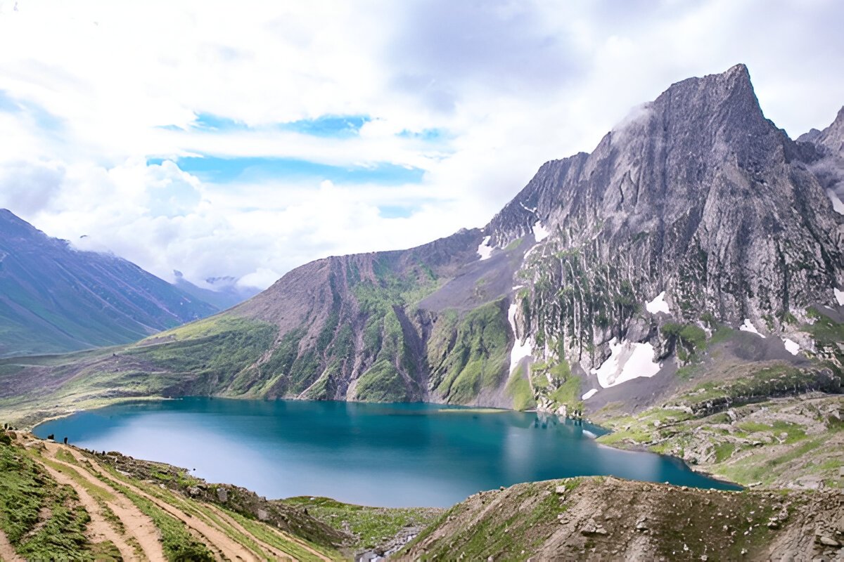
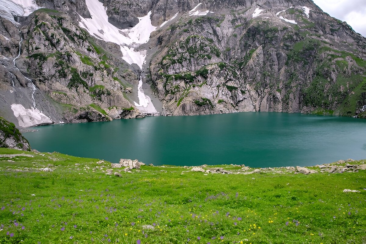
The first lake of the trek and one of the most beautiful ones
If the trek is in July, the lake will be frozen. Otherwise, we can go fishing at the lake, with the permission from Srinagar fishing department.
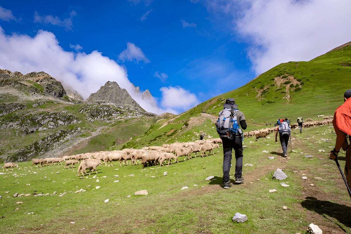
Vishansar is visited by hoards of sheep and their shepherds who always have some interesting stories to tell.
A campsite is a unique place with open ground and you can play volleyball, cricket, etc.
Beware of dogs at the campsite.
Moderate climb to Nichinai Pass (13,000 ft). Small descent followed by a long flat meadow walk ending near Vishansar Lake (12 km, 6 hrs).
We start the day early around 7 or 8 in the morning to begin our trek towards the first of the Great Lakes, the Vishansar Lake. The day's trek is more or less a long walk on the alpine grasslands of Kashmir. Start your trek from Nichinai to Nichinai Pass, which is visible from the campsite. Half an hour into the walk and you have to cross the gurgling stream to reach its left bank. The trail starts ascending here and for the next one hour, you will climb up gradually to the Nichinai Pass. The Nichinai Pass is the highest point in today’s trek and is located at an altitude of 13,100 ft. From the pass, it’s a small descent and then a flat walk on the meadow all the way to the Vishansar Lake.
As you continue climbing the Pass, you will see the lake down below at the foot of the mountains, it appears to be a small deep-blue enclosure. The trail that you are walking on now is not the original ridge and it will turn inwards two times before you arrive at the Nichinai Pass. The Nichinai Pass is like a big tunnel and from the top, you can observe the Sonamarg Valley down below. BSNL network is erratic here and this is the last point where you will get any network. The next traces of the network are available when you have moved past Gangabal. On the left of the pass lies the mighty peaks of the Himalayan region, whereas on the right side, there are no mountains but the ground rises up. While some may find the climb to the Nichnai Pass a little strenuous as it is a straight climb, however, there is good news as the trek post the pass is a downward climb. The trail from the pass descends rapidly and in about an hour, you will reach grassy lands from the rocky area. The meadow is a vast expanse of land spreading far and wide with snow-clad mountains surrounding the entire meadow. There’s another river flowing from the pass into the meadow ahead. To your left, you will also see a big waterfall cascading down and mingling with the river. As you walk on the meadows, you will notice two streams crossing the meadows, stick to the banks of the one on the left, and in about half an hour, you will have to make a stream crossing but be prepared as the water is going to be icy cold.
At the end of the valley, a river flows perpendicularly from left to right and this river actually originates at the Vishansar Lake. The lake is not visible yet as it is a little higher on the top. This is a good place to pitch your tents by the river. After the trek, if you have ample time, you can explore the twin lakes or wait for it until the 6th day. From your campsite, the Vishansar Lake may be about 0.5 km away and about 100 ft high. The Vshnusar Lake is nestled beautifully between 4 mountains and the Kishansar Lake beautifully reflects in the lake waters. The color of the lake changes according to the time of the day and the cloud cover. Before sunrise, the lake is usually colorless, and on a clear day, as the sun rises, the water of the lake starts getting blue on a sunny day, the water of the lake is a deep aquamarine blue. As the sun gets closer to setting, towards the end of the day it becomes a greenish-blue towards the end of the day. This is the first lake you will see on the trek and eventually, you will check other lakes as well. Today we will camp close to Vishansar Lake.
Day 4 is reserved for acclimatization as you need to give your body enough time to adjust to the conditions of higher altitude. The next lake following the Vishansar lake is the Kishansar Lake. Kishansar is 0.5 km away from Vishansar and is situated at the base of the Kishansar Peak. It will take about 45 minutes to trek to Kishansar from Vishansar. You can take a short acclimatization walk to Krishansar Lake for acclimatization purposes. The trail to the Kishansar Lake climbs from the right side of the Vishansar Lake. On the right-hand side of the Kishansar Lake lies a big meadow which is a perfect spot for capturing photographs.
Note: The use of acclimatization day is subject to change to weather conditions. If the weather is really good then we won't stop for acclimatization but rather move forward to the next campsite. Acclimatization day can be used later at Gangabal campsite.
Altitude:
Gadsar 3,350 m/ 11,000 ft
Gadsar pass 4,200 m/ 13,750 ft.
Trek Distance: 14 km | 10 hrs.
We start the trek earlier than usual.
The trail passes from Vishansar To Gadsar via Gadsar Pass, the highest point of the trek.
From Vishansar, the trail takes a steep ascent to Gadsar Pass.
We can spot the Kishansar Lake on the way.
From the Gadasr Pass to the campsite, we descend gradually.
We can spot the Gadsar Lake en route.
You might also spot the glacier of the Gadsar Lake.
After the Gadsar Lake, we will reach the campsite in two hours.
Just a few minutes before our campsite, we will have another army checkpoint and we will have to share our IDs.
A packed lunch will be provided during the trek.
Steep 2 hours ascent followed by a steep descent following a gentle walk in the meadows (5 hrs, 10 km)
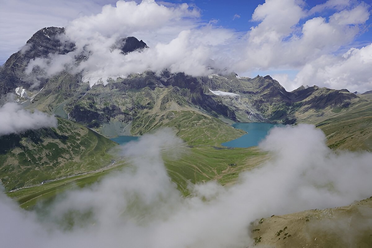
Today we will trek to Kishansar Lake via Gadsar Pass. From your campsite, you can spot a very thin line traveling through the side of the mountain, this is the trail that you need to follow today. A climb of about an hour and a half will take you to the top of a ridge, another 45 minutes in the climb and you will arrive at a spot that will totally captivate you with an amazing view. There comes a point from which you can see the Kishansar and Vishansar Lakes together in full view. This enchanting view accompanies you all the way to the top of the Gadsar Pass. The Gadsar Pass lies at an altitude of 13,750 ft and is the highest point on today’s trek. Relish the view from the top of the Gadsar Pass for a while before moving ahead. On the horizon line on one side are the snow-clad majesties of the Himalayas and on the other side, a gorgeous valley stretches with 2-3 small lakes visible from the top. The peaks that you can see from the top of Gadsar Pass lie out of the Line Of Control (LOC).
Once you reach the Gadsar Pass, it is a steep descent below and en route, you will first spot the Yamsar Lake, a quaint little lake not very popular among the people. Yamsar Lake can serve as the first landmark that takes you to Kishansar Lake. Continue from Yamsar and about an hour of descent will bring you again to flat grasslands or meadows of the beautiful Kashmir Valley. This time the valley is a bit narrower, the mountains surrounding the meadow on either side. Multi-colored flowers line the green grass of the valley and give it an ethereal look. Once you have arrived at the area near the blue Irises, Gadsar is not far away. Soon you will reach Gadsar, one of the prettiest alpine lakes you have ever seen. Gadsar Lake lies at an altitude of 12,000 ft and the sheer beauty of it will leave you speechless. Gadsar is located at the base of mighty snow-covered peaks. On the one side, you will see snow blocks cascading down to the lake from the mountains, and on the other side, you can see colorful flowers and greenery making for a mesmerizing sight.
Gadsar Lake area will be our campsite for the day, although not many people camp here. If you are camping near Gadsar, make sure that you leave the campsite as clean as you found it. If you do not opt for camping by the lake then continue your climb further downhill to the Gadsar army camp. About half an hour into the trek, the narrow valley opens up and becomes wider, you can see another blue lake on the left-hand side of the valley. As you move on, you are losing a considerable amount of altitude. Continue for another half an hour and you will start noticing the Shepherd huts lining the edge of the valley, keep walking and after about half an hour you will arrive at the army camp. The army camp is a small hut that houses 5-8 army men and to move further beyond the camp, you will have to obtain permits from the army headquarters. The headquarter is located three miles from the checkpoint, follow the tree line into the village to find the HQ. The Gadsar army camp communicates with walkie talkie and the HQ is equipped with a satellite phone. A pro tip: When you are near the army camp, report as quickly as possible as it takes about 2 to 3 hours for the green signal to come through from the headquarters. Your ID proofs will be checked, collected, and recorded before you can proceed further.
Altitude: 3,650 m/ 12000 ft.
Distance: 9 km | 6 hrs.
Mid-July to mid-August, the trail is laden with vibrant flowers.
We need to share our IDs at another army check post en route.
Moving on, we see two small lakes which are often mistaken for Satsar Lakes.
We will visit Satsar twin lakes in the afternoon, which are approx. 1.3 hr apart.
Satsar Twin Lake is also known as Mengen Top.
The twin lakes are situated in the middle of two mountains.
Gentle descent or 1 hr followed by a steep ascent for 3 hrs followed by a flat meadow walk.
From the army camp, move left towards the stream, to head up into the mountain. You are now above the tree line and you can see the tree cover and the rivers below you. The climb continues for an hour and a half and you gain an altitude of 1,100 ft. Once you cross past the 11,500 ft mark, the climb transforms into a traverse and bends towards the left leaving the river valley. Once you are out of the river valley, you will be walking on a flat meadow surrounded by mountains on all sides. This section of the trail is called Maegandob and you may also spot a few craters to your right. Soon you will spot first of the Satsar Lakes. The name Satsar translates to ‘Sat’ meaning seven and ‘Sar’ meaning lake. Satsar is a collection of seven lakes which justifies the significance of the name.
If Gadsar Lake was your last camping spot, you can choose to camp here. However, if you camped in the army camp then it is justifiable that you trek a little further and camp near one of the Satsar Lakes. Out of all the lakes, you may find 4 to 5 lakes with water, depending on the season you are visiting Kashmir in. Once you cross the bridge, you will come across another army check post, this will be the third check post on your route, and the same process of checking, collecting, and recording your ID and information will continue. After the procedures are done, you can continue on your trail, and after 10 minutes of walking, you will arrive at the first of the Sat Sar lakes. The lake is set in a picturesque setting with lush greenery and mountain views, and the emerald-blue color of the lake changes hues with time.
Satsar Lake is our camping ground for the day. Find an ideal spot for camping near the lake and pitch your tents. Retire early in your tents and give your body the rest it deserves after a long day of hiking.
Altitude:
Gangabal 3,500 m/ 11,500 ft
Zaj pass 3,950 m/ 13,000 ft.
Trek Distance: 11 km | Duration: 6 hours approx.
We walk on rocky paths for approximately an hour and ascend to Zaj Pass
At the Pass, you can enjoy views of the 4 lakes as well as Mt. Harmukh and its glacier.
From the pass, we descend to Gangabal Lake and camp at Nandkol Lake
We visit the Gangabl Lake, which is one of the largest lakes on the trek.
Mild ascent followed by a gradual descent followed by long steep ascent long steep descent followed by gradual up and down walk.
The trail follows the same pattern of going up and down. From our campsite, we will begin our trek and after half an hour of climbing, you will arrive at the biggest of the Satsar Lakes and also the last one in the sequence. The terrain is mostly rocky and filled with boulders. From the lake, the trail keeps descending and continues for about half an hour on this trail and you will arrive at the first forest line. On your right is a ridge and on your left is the forest line. From here, you will again gain altitude through a zig-zag trail to the top of the first ridge you have to climb two more ridges to reach the top and the terrain from the base to the ridge top is barren and rocky. On the opposite side, you can spot some Gujjar huts and some greenery that is in stark contrast to the barrenness of the trail you are on.
An ascent of about two hours will bring you to the top of the third ridge, which is approximately 13,000 ft. From the top of the ridge, you get an amazing view of two lakes with the stream taking water from the higher lake to the lower, which is one of the most wonderful sights to behold. Look more closely and you will see two more lakes on either side, the name of the smaller lake is not known while the biggest lake amidst all of them is Gangabal with its companion Nandkol. The route descends and ascends as you climb down about 1,400 ft to the lake.
There are no water sources on the ascent, during the descent, you will come across a stream, and crossing the wooden bridge, you will arrive at Nandkol your camping site for the night. Nandkol campsite is a popular camping ground and as such a Green Trails Hotspot. You can spot remnants of camping here and there. A lot of people come from Naranang to Gangbal for a weekend outing and that leaves the places with a good deal of waste. Nandkol and Gangbal are also famous fishing destinations, especially trout fish. The Gangbal Lake is at a distance of 20 minutes from Nandkol and a stream connects both of them. We have to cross the stream to reach one lake from the other. Avoid crossing the stream from the lower level, instead, go all the way to Gangbal and you will find a bridge laid out. Gangbal Lake is a big one and circling it will take at least an hour.
Altitude: 2,250 m/ 7,450 ft.
Trek Distance: 15 km | 7 hrs approx.
The trail is a descent till the last point of the trek - Naranang, so take care of your knees and ankles.
The trail will pass through pine tree forests.
On advance booking, TTH can arrange transport to Srinagar at a charge.
* Please Note that prepaid SIM cards do not work in Kashmir.
Don’t forget your ID proof in original and 2 photocopies.
On Day 8, you’ll reach Srinagar between 6:30 pm and 7:30 pm. You can book your travel any time after 8 pm.
Gradual descent followed by a steep descent.
Although today is a complete downhill climb the steep descent is going to be hard on your knees so be prepared. From your Gangabal campsite, climb down through the ridge following the stream towards the tree covers. 30 minutes into the trek and the Airtel network begins to catch network, you can inform your home that you have made it down safely! As the ridge ends, you arrive at a flat meadow. From here you can look back and see an impressive image of Harmukh Peak, standing tall and mighty.
An hour into the trek and you will begin to enter the treeline, which mostly consists of Pine trees and you will also begin to see signs of civilization as a log hut comes into view. For about 6 km you will keep making your way in and out of the forest not really losing much altitude. After two-thirds of the distance is covered, the trail begins to descend and it is a really steep descent. The trail here is muddy and well-trodden and through thick pine covers. The last 4 km of the trek is a huge drop where you lose an altitude of more than 3000 ft. You may even spot a lot of trekkers on your way down, they are trekking from Naranang to Gangabal. Naranang slowly comes into sight, a little bit more to go. The last part can be a test of your endurance as it is quite steep. A little further and stone-paved path comes along and in a few minutes, you enter the village of Naranang. From here, you will drive to Srinagar. Expect to reach Srinagar by 6:30 pm. From here on you can book your further travel ahead.
Chopta Tungnath trek serves as an unique adventure, providing you a blend of thrilling challenges, v...
View this Package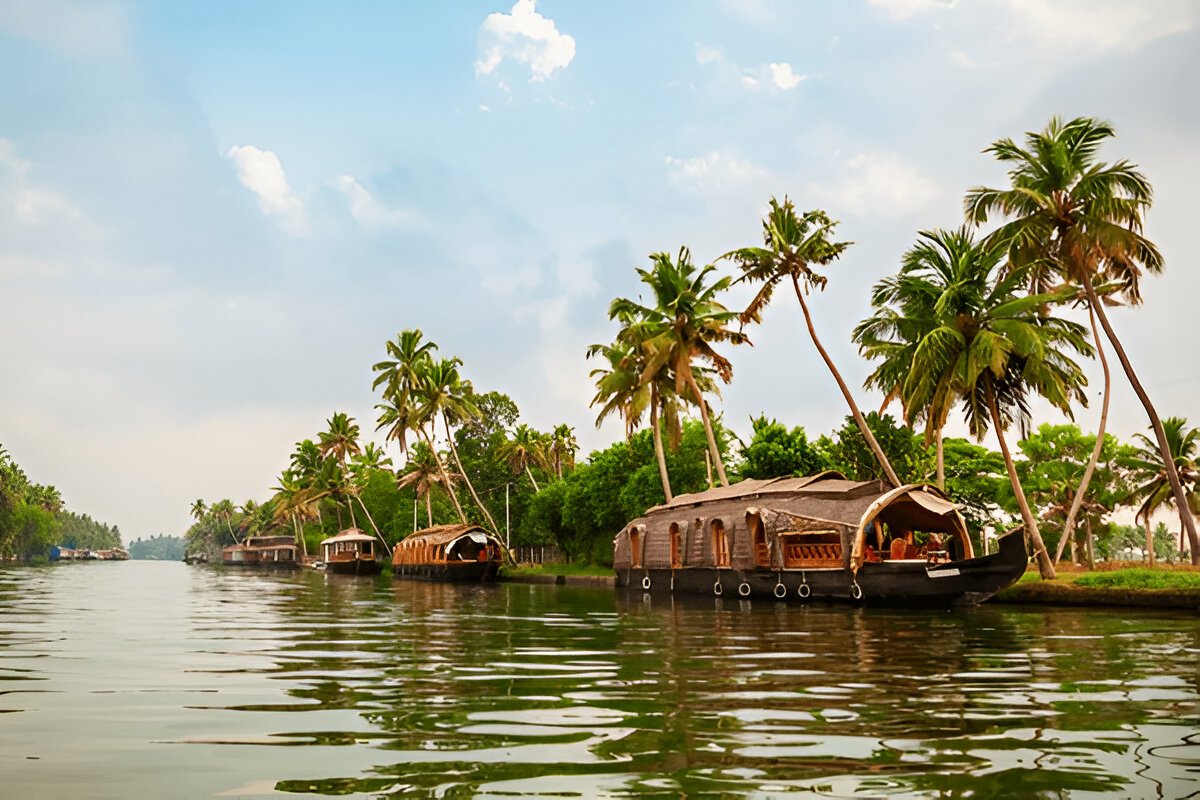
Embark on an enchanting 4N/5D Kerala adventure with our Explore Kerala Tour Package. Your journey be...
View this Package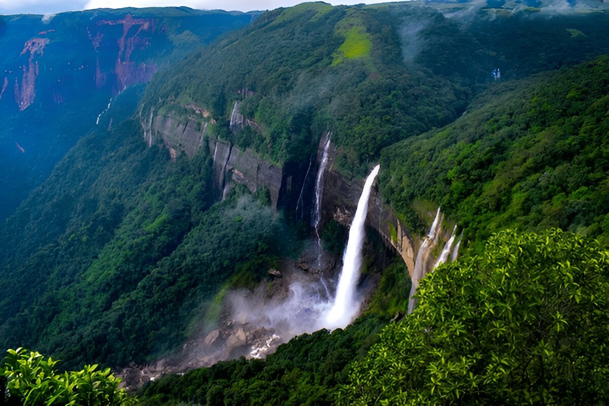
Embark on a captivating journey through the North East with this 6-day tour. Start with a scenic tra...
View this Package